Monday June 28
Today we stayed in port. It was raining and had rained all night. We were going to go to the Arctic Circle today up the Dempster Highway, maybe even all the way to Inuvik. This road and the Top of The World Highway are said to be slippery when they are wet. They are both gravel roads so they would be muddy and dangerous on the hills. They tell me they will be fine 2 hours after the rain has stopped. Late this afternoon the rain stopped and the sun came out. Look out Arctic Circle, here we come in the morning.
Today we laid around and took it easy. We went to town to get some groceries and walked around some more. I talked to Mike again on Skype and he told me how to fix the oven over the computer. We did not have toast this am because the oven would not light. Mike googled it, I didn't think to, and told me what to do. It worked. We went to bed last night at 1am in the light and were not sleepy. We kind of needed a down day and the rain gave us the excuse.
Sunday June 27
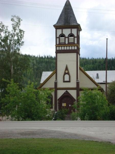
We only had an hour ride to Dawson City. Found us a campsite and went to explore the town. As you see in the pictures it is an old west type of town. Everything is about the Klondike gold rush an gold mining. This was where it happened and in the late 1800's and early 1900's it was a wealthy town. There is a lot of history here and the town is not over developed.
Being Sunday there were a lot of people milling about on a sunny afternoon.
I did the most amazing thing. Mike had me download Skype. I signed up kind of like doing an emailing account. Mike has it on his computer too. With Skype we can call each other over the internet! No phone lines or phone companies involved. The best part is it is free computer to computer. There is a paid option for some other stuff. Both have to be on line before one can call the other. I called Mike and we talked through the computer. The wildest part, we both clicked the video button and we could see each other real time as we talked. Both computers have to have a camera. Here I am 250 miles from the Artic Circle, nearly 5000 miles from home, and I watched him setting in my recliner talking to me. I even got to see the granddogs. All over the internet and for free....................................
Tuesday, June 29, 2010


Local housing development

roofs. I'll try and get a better one.
Truck Grill

seem them on Fords and Dodges too. Help keep bugs out of the radiator.
I used screen wire.


Pontoon house boat on Klondike River

the muddy half. That was Sunday. Monday the whole river was muddy.


Remember 5 finger rapids?

a sign in downtown Dawson City.


Tribute to Gold Miners

1898 just outside of town. This was the heart of the gold rush and gold
is still mined here today.


Monday, June 28, 2010
Saturday June 26
Today we looked around White Horse a little. The town is large for the area, small for what we are accustomed to. We saw the Klondike a paddle wheels steamer that use to run on the Yukon River. Town was made to look old and western. No buildings were over 3 stories. We headed out and left the Alaskan Highway to take the Klondike Highway to
Dawson City, not to be confused with Dawson Creek. Dawson City was where the Klondike Gold rush started in 1898. This route is also know as the Klondike Loop which takes you across the Top Of The World Highway into Eagle, Alaska. This highway is a 60 mile gravel road run across the ridge line of the mountain range. It is 100 miles longer than staying on the Alaskan Highway but everyone says it is worth it. Me met two couples tonight where we are parked and they said it was one of the prettiest things they had seen in their trip. they are returning from Alaska to Idaho.
We stopped at Montague House for a world famous cinnamon bun. It is 8 or 9 inches in diameter and the advertise it will feed 4. In the morning we will test that. The Montague is an official check in point on the 1000 mile sled dog race.
We stopped at an overlook to take pictures of what is called "5 finger rapids" on the Yukon River. It was a dangerous set of rapids back in the day. Deatra saw some inn where Martha Stewart had done a show.
I saw a brown, grizzly, bear cross the road about 1/4 a mile ahead. He paused beside of the woods to look at us as we stopped in the road. I only got one picture before he departed. Wow!
We stopped long enough at Moose Creek Lodge to take a picture of a wooden model of a giant mosquito. A good 5 foot mosquito.
Finally we stopped at a gravel rest area overlooking Gravel Lake. Again this lake is used by birds in migration. There were two swan, and a bunch of different types of ducks. Ask Deatra for details, they all look alike to me. There are 4 other campers here tonight. I see mosquitoes swarming outside in the sunlight at 10:30. I hope we can keep the out tonight!
Today we drove 282 miles. We drove between 50 and 55 mph all day as we crossed the Dawson Mountain Range. Tomorrow we plan on finishing the 40 miles to Dawson City and spending the day and night there studying the gold rush history. Maybe we will strike it rich!!!!

This map don't look like mine

pretty extensively.


We have seen a lot of roadies up here

crashed on the rough surface of the Top Of the World Highway today and
broke his leg. A volunteer carried him to Chicken, AK to get treatment.


Montague house

get a meal or place to stay.
Sunday, June 27, 2010
Friday June 25
We got up today and went back to the sign post forest to get another picture as we missed the main entrance. We tried repeatedly to get out on the cell phones. Had all the bars but the calls would not go out. Weird place if you ask me. We crossed into the Yukon Territory today from British Columbia. We drove to Teslin and went in the trading post. They had a little of everything. I had been craving pork and beans for a few days. I got me a large can and a chocolate donut. Deatra got a can of spaghetti and a cream filled donut. We drove a few miles to a stop on Teslin Lake. We had lunch, the beans were great, and took O for a walk. He went swimming and drank some lake water. The wind was blowing and making waves that kept hitting him. He didn't much like that. Telsin lake is a major lake for the migration of birds. It is also a major hunting and trapping area around it. Before the highway it was used for travel to hunting grounds. Somewhere today we crossed the longest bridge on the Alaskan Highway.
We ended up in White Horse. The Wal-mart parking lot is smaller than the Kmart parking lot in Burlington yet their must be 50 campers parked here. We almost didn't get a spot. The Wal-marts here close early, around 10:00. Of course you never know what time it is anyway with the sun not setting. At 10 o'clock you would be it is about 5 pm. Finally you just get tried and go to bed around midnight.
We drove 275 miles today from Watson Lake to White Horse. I only got a little gas to tide me over until I could get it cheaper. I paid $1.129 per liter or $4.257 per gallon. Then I found some for $1.099 per liter or $4.15 per gallon. That is using the Canadian dollar one to one with the US Which it is not but within 2%. Mileage for the day was 8.246 mpg. This better mileage is a welcome relief with the prices of gas.


highway messages

stones. Different messages appear all along the highway for miles and
miles. Some new some older and deteriorated.
Friday, June 25, 2010
Note:
You will have to click "older posts" to looked at the next page. Repeat this until you get to Monday and you will have seen all of today's postings. Good Night!
Thursday June 24 We made it to the Yukon
Today we didn't drive very far, only 69 miles. We stopped in Watson Lake, Yukon and just stayed. We went to the visitors center where we got all their secrets. Lots of information both written and verbal. There we watched a short movie about the Alcan and looked at their exhibits.
We then did the Sign Post Forest with well over 10,000 signs. For those of you who don't know the story I'll give you a summary. In 1942 a homesick GI named Carl Lindley put up a sign pointing the way and mileage to his hometown of Danville, Il. Others followed his lead and in 1990 the 10,000th sign was added. They maintain this and are still adding signs. You can't read them all.
We went shopping in a variety store named Houegen's where they had a little of everything. Then we came back worked on the blog, emails, and grilled some steaks.
Yesterday before we stopped for the night we were getting low on gas, below 1/2 tank. Gas stations are a long ways apart up here. I pulled into a small station at Liard Hot springs and it was $1.49 a liter which is $5.64 a gallon American. I pulled off and said I would run out before I paid that much. Luckily today I ran across another station that had it for $1.06 per liter which is $4.12 per gallon. This is about the going rate in this part of the world. Yesterday's mileage was 7.93 miles per gallon which is not bad crossing the mountains. We are about 600 miles from Fairbanks Alaska. In less than two tanks fulls we will be back in the US.
Tonight we sprang for the $21 campground in town. This gave us wifi and a place dump of both tanks, electricity to charge everything, and a fill up with water. No phone service here. It rained a little today but then the sun came out. The temperatures have been in the 50's at night and 70's in the day time. Pretty nice overall.
Tomorrow we head for Whitehorse and turn north toward Dawson City, the heart of the Klondike Gold Rush. From there it is over the Top of the World Highway and into Alaska. We may just spend the 4th of July in Chicken or Eagle Alaska. That should be a hoot in these small towns.
I put up a ton of pictures today so you will have to go through several pages to see them all. Be patient they are slow loading but I hope worth the wait.


Subscribe to:
Posts (Atom)